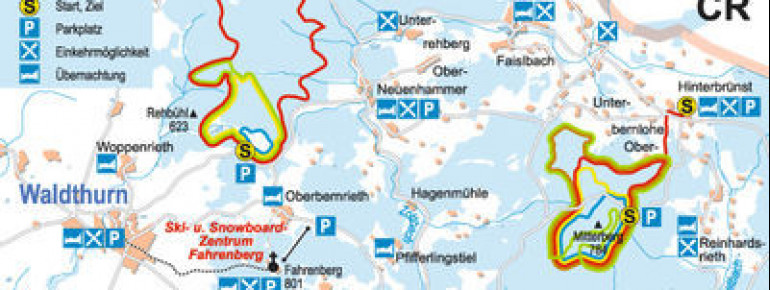
+
+
Cross-Country Skiing Area Fahrenberg in the Uper Palatine Forest: Position on map

Cross-Country Skiing Fahrenberg

Waldthurn, Pleystein, Vohenstrauß

Trail Map Fahrenberg
© Naturparkpland Oberpfälzer Wald

Interesting facts

  • The highest point of the track is 629 m above sea level.
  • Snow coverage is usually best during February, offering an average snow depth of 34 cm at summit elevation and 34 cm at the base.

Contact

Comments

Rate the Cross-Country Skiing Area
Advertisement

Weather (801 m)

Facts

Elevation629 m - 629 m
Skating km
Classic 45 km
Lighted trails km

Cross-Country Trails

Easy
Moderate
Advanced
Overall 45 km