
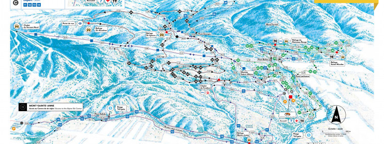
The Cross-Country Area
The Mont Sainte Anne nordic ski area counts as many as 200 kilometers (124 miles) of loipe, making it one of the largest cross-country ski areas in North America. Cross-country skiers of every level will find their perfect challenge in this vast area. The resort also offers skiing lessons, for those getting started on corss-country skiing or just looking to brush up on their skills.
The area is located in the Laurentian forest, an area well worth exploring due to its great variety of beautiful tree species. Beside through cross-country skiing, winter sports fans can do this on snowshoes or riding a fat bike. All equipment can be rented in Chalet St-Julien.
Interesting facts
- Offering 200 km cross-country trails, Mont Sainte Anne is among the 3 largest Cross-Country Skiing Areas in Canada.
- The high point of the cross-Country skiing area is located at an elevation of 800 m.
- Snow coverage is usually best during March, offering an average snow depth of 409 cm at summit elevation and 0 cm at the base.
Dining along the Tracks
A number of shelters are located along the trails, such as the famous Chalet du Fondeur.